ALERTS & UPDATES:
Hiking & Recreational Trails
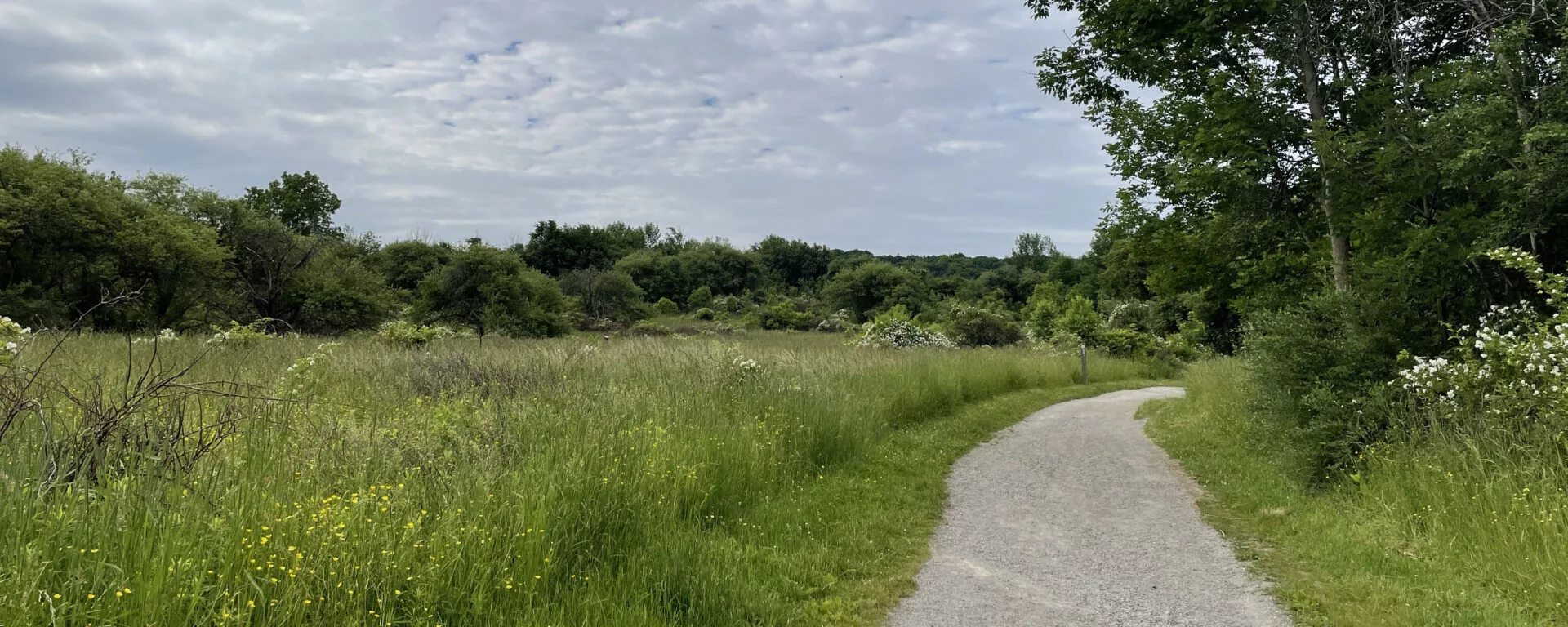
Explore Hamilton Conservation areas in all seasons on our 180+ kilometres of recreational trails, you’ll always find something new!
Click here for area brochures and trail maps.
Conservation Area Trails
- 10-kilometres of recreational trails
- 6 main recreational trails with access to others
Explore pine plantations, circle the lake or head to the west side of Middletown Road to hike the Wildlife Area. Christie Lake never disappoints when it comes to nature!
Recreational Trails
Hill and Dale: 1.1-kilometres one-way
Lafarge 2000 Trail: 22-kilometres one-way
Round the Lake: 5.6-kilometre loop
The By-Pass: 0.64-kilometres one-way
Wedeln Run: 0.48-kilometres one-way
White-tailed Deer: 2.6-kilometre loop
Learn more about Christie Lake and view brochure and trail map.
- 4+ kilometres of trails
- One main trail with access to others
- Confederation Beach Park Map
- Hamilton Beach Recreational Trail Map
Walk along Lake Ontario as you stroll down the Hamilton Beach Trail. This trail is paved and connects to the Waterfront Trail, running an additional 4.2-kilometres west to Burlington. There is also access the Red Hill Valley Trail from the Park.
Recreational Trail
Hamilton Beach Trail: 4.3-kilometres one- way
- 40-kilometres of recreational trails
- Six main recreational trails with access to others
Highlights of the 1,200-hectare conservation area include lush Carolinian forests, colourful meadows, cold-water streams, stunning geological formations, and an array of rare plants, birds, and wildlife.
Recreational Trails
Hamilton to Brantford Rail Trail: 32-kilometres one-way
Headwaters Trail: 10.5-kilometre loop
Heritage Trail: 1.8-kilometres one-way
Main Loop: 3.4-kilometre loop
McCormack Trail: 7.5-kilometres one-way
Monarch Trail: 5.1-kilometres one-way
Spring Creek Trail: 3.3-kilometres one-way
Bruce Trail
A section of the Bruce Trail travels through the Dundas Valley. It is Canada’s oldest and longest marked footpath. It spans more than 885-kilometres of main trail and 400-kilometres of associated side trails. Visit their website for more information.
Learn more about Dundas Valley and view brochure and trail map.
- 7+ kilometres of recreational trails
- Three recreational trails with access to others
Filled with underground caves and streams, meadows and forests, the Eramosa Karst is one of the watershed’s unique natural gems. It also provides access to the East Mountain Trail Loop.
Recreational Trails
Bobolink Trail: 1.9-kilometres one-way
Karst Features Trail: 2.8-kilometre loop
Meadows Trail: 2.1-kilometres one-way
Learn more about Eramosa Karst and view brochure and trail map.
- 3.4-kilometres of recreational trail
- One recreational trail
Enjoy a hike around the entire conservation area, with views of Lake Ontario, the marina, and a bridge crossing over the Fifty Point pond and past the historic Ingledale House.
Recreational Trail
Fifty Point Trail: 3.4-kilometre loop
Learn more about Fifty Point and view brochure and trail map.
- 4.3-kilometres of recreational trail
- One recreational trail
Fletcher Creek Ecological Preserve is a unique natural area. An abandoned quarry was rehabilitated, resulting in the creation of a rare type of wetland. The area also includes boardwalks and stunning views.
Recreational Trail
Quarry Trail: 4.3-kilometre figure-eight loop
- 2+ kilometres of recreational trails
- Three recreational trails
- Connection to the Dofasco 2000 Trail
Explore HCA’s newest conservation area and enjoy views of the recently constructed wetlands, providing crucial habitat and reducing flooding and erosion below the Niagara Escarpment.
Recreational Trails
Heritage Green Community Trust Trail: 0.7-kilomtres one-way
West Wetlands Trail: 0.8-kilometres one-way
East Wetlands Trail: 0.7-kilometres one-way
- 4.7-kilometres of recreational trails
- Three recreational trails
There are two separate accesses to the Spencer Gorge; one at Webster Falls and the other at Tew Falls and Dundas Peak. Each area offers a trail
Recreational Trails
Webster Falls Trail: 1.1-kilometres
Dundas Peak Trail: 1.7-kilometres
Glen Ferguson Side Trail: 0.9-kilometres
- 10-kilometres of recreational trails
- Four recreational trails
Hiking at Valens Lake is beautiful any time of year. Hike through the trees, with views of the lake, cross the 300-metre boardwalk, or fishing bridge which crosses the lake.
Recreational Trails
Boardwalk Trail: 3.2-kilometre loop
Lakewood Trail: 2.4-kilometres one-way
Open Field Trail: 1.5-kilometres one-way
Rabbit Run Trail: 0.5-kilometres one-way
Learn more about Valens Lake and view brochure and trail map.
- 6.7-kilometres of recreational trail in addition to the village
There’s more than just heritage buildings at Westfield! Walk the recreational trail system which passes by a couple of ruins sites and though the forest. This unique location offers a step back in time and through the woods.
Recreation Trails
Giant Swallowtail Trail
Chinquapin Oak Trail
Chinmaya Trail
Sugar Shack Trail
Tanager Trail
Learn more about Westfield Heritage Village and view brochure and trail map.
Additional Recreational Trails
Sections of the Bruce Trail travel through the Dundas Valley, Devil’s Punchbowl, Felkers Falls, and Vinemount and Winona Conservation Areas. The trail is Canada’s oldest and longest marked footpath, spanning more that 885-kilometres of main recreational trail, and 400-kilometres of associated side recreational trails.
- 15-kilometres one-way
The Chippewa Trail follows an abandoned rail line south from the Chippewa Trail Parking lot to Caledonia. After passing through an industrial area in Stoney Creek, the trail opens up into rolling farmland and natural areas. A point of interest is the old rail bridge that crosses Twenty Mile Creek. The trail is mostly flat and is easily accessible.
- 11.5-kilometres one-way
The Dofasco 2000 Trail connects bikers and hikers to a growing list of conservation lands including Devil’s Punchbowl Conservation Area, Saltfleet Conservation Area, Sinclair Sugar Bush, Vinemount South Swamp, Vinemount Wildlife Sanctuary, and the Saltfleet North East woodlot. Visitor favorites include access to wetlands and trails at Saltfleet Conservation Area and the 1.7-kilometre boardwalk through the heart of the Vinemount South Swamp.
- 32-kilometres one-way from Hamilton to Brantford
- Hamilton to Brantford Rail Trail Map & Brochure
Canada’s first fully developed entirely off-road interurban recreational trail, the Hamilton to Brantford Rail Trail uses the abandoned route of the Toronto, Hamilton & Buffalo Railway. The trail intersects and runs through the Dundas Valley in several areas.
- 22-kilometres one-way
The Lafarge 2000 Trail offers users a varied look at the unique natural features along the trail, including the Beverly Swamp, Dundas Valley, and Christie Lake. It is an important part of the trail network that surrounds the Hamilton area.
HCA Contact Information
Phone: 905-525-2181
Email: nature@conservationhamilton.ca