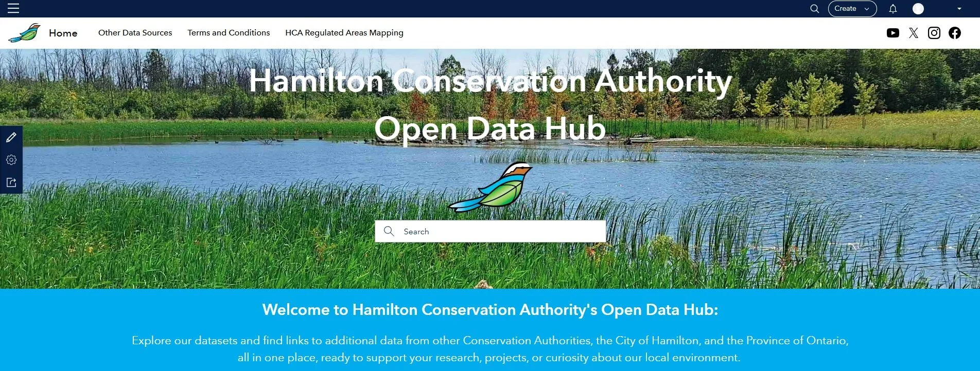
Hamilton Conservation Authority is pleased to announce the launch of its new online Open Data Hub. This platform provides public access to mapping and environmental information, including watershed boundaries, stream networks, elevation data, land cover, and more.
The Open Data Hub is designed for a broad audience, including students, researchers, consultants, and members of the public who wish to explore and download watershed-related data.
This launch is part of HCA’s ongoing commitment to make environmental information easier to find, use, and share. Additional datasets will be added over time, ensuring the Hub continues to grow as a reliable source for watershed mapping.
Whether you are exploring local waterways, conducting environmental reviews, or studying how water moves through the land, the Open Data Hub offers a reliable starting point for understanding our watershed.
Explore the data here:
Hamilton Conservation Authority Open Data Hub
Open Data is information anyone can access, use, and share, at no cost. In our case, it means maps and environmental data freely available to the public. You can view the data online or download it for your projects, research, or curiosity.
Examples include:
- Boundaries of watersheds and subwatersheds
- Stream and river networks
- Elevation maps
- Land cover details (forest, water, farmland, urban areas)
Open Data helps increase transparency, supports learning and research, and encourages informed decision-making about our environment.